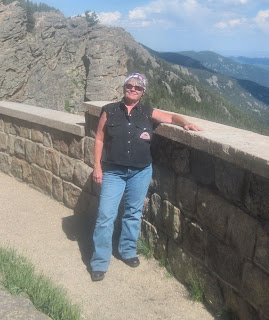
Our Harley Days
Our Rides... Our Adventures... Our Family and Friends...
Traveling free and easy down a road that never ends...

Saturday, August 27, 2011

Road Trip #5 - Day 9 The ride home through Snowy Range, WY

August 27, 2011
Colorado, USA

Day nine found us within a day trip's distance to home so we decided to head in that general direction. We rolled out of Meeker about mid-morning in no particular hurry. We rolled lazily north on Hwy 13 to Craig where we topped off the tank and found breakfast at The Village Inn.

After breakfast, we continued north on Hwy 13 and traveled out of the state into Wyoming. In Baggs, WY we turned east on Hwy 70. Something about this route bugged me. About 30 miles out or so I remembered rather abruptly why when we ran upon a caution sign - one lane road ahead. Hwy 70 in Wyoming made the news back in May when about 600 foot of highway collapsed in a landslide. Repairs have proved difficult, obviously, since it doesn't appear much has been done. It was sort of a HS moment when we rolled over the nasty one lane part wondering what was holding the rest of the road in place. (Sorry - didn't have the camera handy enough as we rode by.)
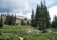
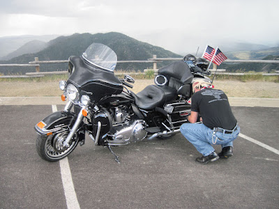
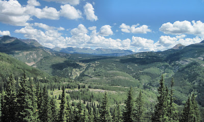
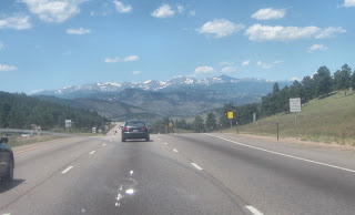
Snowy Range WYWe picked up Hwy 130 north of Riverside and rode east over the Snowy Range which is part of the Medicine Bow Mountains. This is a great scenic ride, much of it traveling through the Medicine Bow Forest and past rugged, jagged peaks, crystal painter's lakes and alpine meadows blooming with wildflowers. It can snow here any time of the year. It is usually chilly and damp and so it was today. We pulled on our jackets at one pulloff near Battle Pass (elevation 9955) and continued on.
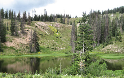
Alpine LakeAlpine Lake - Snowy Range, WY

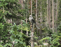
Robber JayAs we rolled up on the jagged part of the mountain range popular with tourists we pulled into a small, secluded picnic area we have used before. Tim dug the thermos out of the saddle bag and announced the coffee was still warm enough to drink. We munched on animal crackers, m&m's and sipped coffee. Before long a couple of Gray Jays, better known as Robber Jays started working our table. They are beautiful birds and fun to watch. They made off with a good portion of our cookie stash. (I shot some video of the stinkers - will get that up soon.)
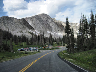
Snowy RangeSnowy Range, WY - Medicine Bow Mountains

We had thunder and the clouds started spitting on us as we fed the last of our cookies to the Robber Jays. Time to go. We managed to ride out from under the rain clouds but the skies remained iffy all the way home. We picked up Hwy 287 in Laramie and rode south to Fort Collins. Much to the amazement of our neighbors, we managed to roll in dry in between thunder storms.

Slide show of today's ride home through Snowy Range, WY (92 photos):


Today's mileage = 355 miles
Ending mileage 27001 (for real - we rolled over 27,000 about two blocks from the house).

It was a great road trip, one we are sorry to see end... but I can betcha by the time we get around to drinking that second pot of coffee in the morning, we'll have the road map out figuring out where we will ride next weekend.

Road Trip Recap
Day 1 - Fort Collins to Colorado Springs to Veterans Rally in Cripple Creek and back to Colorado Springs
Day 2 - Colorado Springs to Woodland Park POW-MIA Recognition Ride to Veterans Rally in Cripple Creek and back to Colorado Springs
Day 3 - Colorado Springs to Cortez, CO
Day 4 - Mesa Verde Ride, Indian Dances in Cortez
Day 5 - San Juan Scenic Skyway Ride - Cortez to Durango to Silverton (Million Dollar Highway) to Ouray to Ridgway to Telluride to Dolores and back to Cortez
Day 6 - Cortez to Gunnison via Wolf Creek Pass and Silver Thread Hwy
Day 7 - Gunnison to Crested Butte, back to Gunnison to Blue Mesa Reservoir and north Rim of Black Canyon of the Gunnison to Grand Junction
Day 8 - Grand Mesa Ride, Rim Rock Ride of Colorado National Monument, to Rifle to Meeker CO
Day 9 - Meeker Co to Craig Co to Baggs WY to Snowy Range WY to Laramie and home to Fort Collins CO

Nine days, 2187 miles, 1 rally (Salute to American Veterans Rally), 1 organized ride (POW-MIA Recognition Ride), 12 passes, (Ute Pass, Wilkerson Pass, Trout Creek Pass, Poncha Pass, Wolf Creek Pass x2, Coal Bank Pass, Red Mountain Pass, Lizard Head Pass, Spring Creek Pass, Slumgullion Pass, Battle Pass, WY) 3 divides, (Continental Divide (several times), Molas Divide, Dallas Divide), 2 mesas (Mesa Verde, Grand Mesa) and too many canyons, lakes and mountains to name -- plus 4 new friends. Wooooooo! Hooooooooooooooooo!

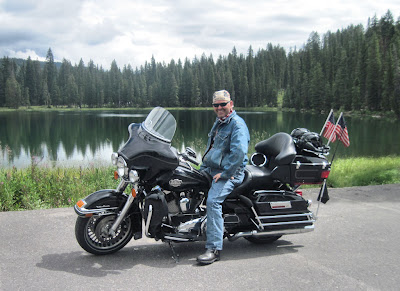
Friday, August 26, 2011

Road Trip #5 - Day 8, Riding the Grand Mesa and Colorado National Monument

August 26, 2011
Colorado, USA

What a great day! We managed to get in two rides we have been meaning to do for quite some time and both of them exceeded our expectations.

After a restful night in our little motel, we rose to beautiful blue skies and the hope they would last most of the day. Heck, a whole day of blue skies sounded like heaven, but we would take what we could get.

We swallowed some oatmeal, craisins and a cinnabun which were the meager offerings at the motel's continental breakfast. The coffee - geez - is there some rule that motel coffee has to taste awful? Ha!

Part 1 - Riding the Grand Mesa

The idea we came up with last night over a couple of beers still sounded plausible this morning so we rolled out on Hwy 50 to ride The Grand Mesa. We approached it from the south side via Hwy 65 just outside of Delta, CO. A friend who is from Grand Junction told us about riding the Grand Mesa. He was right. I would have never guessed how much is going on up there. In addition to the forest, lush green alpine valleys and outstanding vistas of the Grand Valley below, there are little towns, motels, small businesses, farms, camping, fishing, hiking, the Powderhorn Ski area and all kinds of fun stuff. Grand Mesa is allegedly the world's largest flat top mountain, being about 40 miles long with an area of about 500 square miles. There are over 300 lakes on the mesa. Rising about 5000 feet above the valleys below it reaches an overall elevation of over 11,000 feet. It was warm enough to ride out of Grand Junction in short sleeves, but about a third of the way up the mesa, we stopped and pulled on our jackets. We had a little intermittent rain. We stopped at the Visitor Center and roamed around for a while and snapped a couple of photos beside Cobbet Lake. The descent on the north end of Hwy 65 lets out into a great canyon before the road junctions with I-70.

Tim - The Grand MesaTim enjoying The Grand Mesa ride

Slide show of Grand Mesa ride (69 photos):


Part 2 - Riding the Colorado National Monument

We have visited Grand Junction many times and have often wondered about the Colorado National Monument. A little research revealed there is a drive along the rim of the monument that sounded like fun. It is fun. Riding the few miles back to Grand Junction after Hwy 65 dumped us out on I-70, we followed the signage in town to the monument entrance. Next time, we will look for a better route as the signage led us through the urban area of Grand Junction where we encountered too many lights and too much traffic. As soon as we paid our entry fee to the park ($5 for a motorcycle), we pulled over and shed our jackets. On top of the mesa, the temps had dropped into the 50s. Now we were in the 90s.

Rim Rock Drive is 23 miles of fun riding. The monument is about 32 square miles and encompasses over 20,000 acres. The road immediately ascends to spectacular height via some tight twisties. There are several great pull offs, a tunnel and observation points all along the way. Monument Canyon runs the width of the park and includes rock formations with names like Independence Monument and the Coke Ovens. From several vantage points you get a spectacular view of The Grand Mesa, the Book Cliffs and Mount Garfield across the Colorado Plateau.

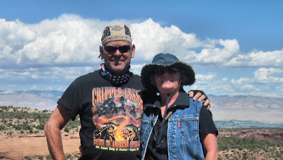
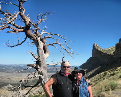
Tim & Vik - Colorado National MonumentTim and Vik - Colorado National Monument near Grand Junction, CO

Slide show of the Rim Rock Ride (95 photos):


First stop after the Rim Rock Drive was a convenience store for ice cream and something cold to drink.

Part 3 - The road to Meeker, CO

We had thought we might ride scenic Hwy 139 north out of Grand junction today as Douglas Pass is another fun ride. Black clouds and rain shafts hovering in that direction changed our minds about that. Instead, we rode east on I-70 to Rifle and picked up Hwy 13 north to Meeker. Meeker was more-or-less the destination we had in mind for the end of the day.

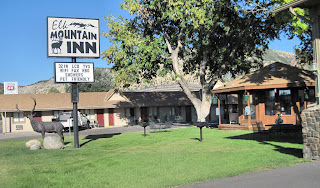
Elk Mountain InnElk Mountain Inn - Meeker, CO

We checked into the last room available in the Elk Mountain Inn. There was another Harley in the parking lot. The rest of the vehicles belonged to road construction crews. The room is a pleasant surprise! Actually, this is the best room we have stayed in since we left The Mecca Motel in Colorado Springs last Sunday. Nicely appointed, roomy and clean. Immaculate is a better word.

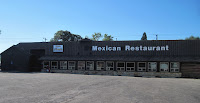
Fiesta Guadalajara - Meeker, COAfter freshening up, we headed across the street to a Mexican Food restaurant in search of sustenance and maybe a margarita. We found ourselves slowly approaching the Fiesta Guadalajara Restaurant, contemplating whether to venture into a restaurant that had not a single car in the parking lot. We entered the foyer which is basically a mud room or mud hall, typical of older restaurants in snow country. It was not clean and furniture and other stuff was piled up at one end. I was about to voice my opposition to the idea of eating there when Tim homed in on a beacon at the end of the hall and was already half a dozen steps ahead of me. The beacon being a beer sign. Too late - said the little voice inside my head - might as well live dangerously. Ha!

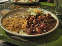
Camarones DiabloThrough the glass doors we went and found ourselves in a nicely appointed, brightly painted Mexican decor. We were greeted immediately and seated in a booth. Well, since we were the only customers in the place, we agreed if we didn't like the menu, we would order a margarita and some chips and salsa and take it from there. You can judge Mexican food by the quality of the chips and salsa and a margarita. As it is, the menu was wide open, listing all the traditional Mexican dishes in the proper lingo, including those with fish, shrimp, pork and chicken. The chips were fresh and the salsa was good. The margarita was a bit on the sweet side for me but Tim liked it. Our meals were served up hot and plated nicely, camarones diablo (spicy shrimp and mushrooms) for me and a huge sampler platter for Tim. Both meals were great, that includes the real freshly prepared, refried beans and rice (no canned stuff). The red chili sauce on my dish was tangy and warm with body. Very tasty. We took our time and enjoyed the meal. By the time we left, the restaurant had a nice crowd of locals, construction workers from our motel and tourists.

After our meal, we strolled across the street. I called The Folks while Tim settled in at table in the lush, green common area with a beer he had purchased earlier from the convenience store across the street. Before I had finished my conversation with Mom, the couple on the other Harley had joined Tim. We enjoyed an evening with Vivien and David from Utah, swapping ride stories and laughs until well after curfew. We swapped contact information and promised to touch base with each other when we rode into the other ones territory.

Here is a slide show of the ride to Meeker, CO (20 photos):


Today's mileage = 219.6 miles

More info:
The Grand Mesa
Colorado National Monument
Rim Rock Drive

Road Trip #5 - Day 7, Blue Mesa Reservoir and Black Canyon of the Gunnison

August 25, 2011
Colorado, USA

We spent a restful night at the ABC Motel and had light rain sometime in the night. The morning was cool and clear.

You should have seen Tim's face when I pronounced that today was laundry day. After six days on the road - it was either time to ship our clothes home and buy new ones at Walmart (a viable option) or do laundry (a somewhat more economically viable option). The motel did not have a guest laundry but I had spied a laundromat on the way into town yesterday. Sure, I gave the guy a break when I said he could drop me off at the laundromat while he ran the bike through a car wash and searched for coffee for the thermos. This is how it went. I washed the first load. Tim showed up about the time they were dry. We changed into the clean clothes and washed the second load. Now, we had a fresh start for the rest of the trip.

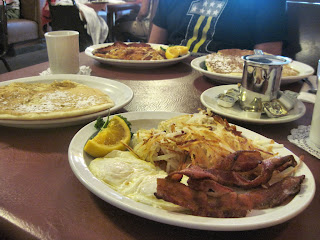
By the time we were done with our chores, we thought we deserved a good breakfast. And, nothing would do but to have breakfast (OK - Brunch) at the W Cafe downtown Gunnison. Yum! We were delighted to be seated immediately. The place is small and usually packed with a group of people waiting around outside. Last time we had biscuits with our two egg breakfast and they were great. The dinner-plate size pancakes we ordered this morning were as good if not better. We managed to munch our way through the mountain of hash browns and bacon that looked more like strips of ham. I repeat - Yum! As always, the coffee was hot and the wait staff friendly and efficient.

The Ride - W CafeThe Ride - just washed - sits outside The W Cafe - Gunnison, CO

Breakfast - W CafeThis is the two egg breakfast at The W Cafe - downtown Gunnison, CO -- YUM!

We learned from people at the cafe that the bicycle ride had brought over 35,000 people to Gunnison and Salida. Yikes! We are glad we missed that and vowed to continue dodging it. After brunch, we decided to ride Hwy 135 to Crested Butte. If we have ever traveled this stretch of road, or visited Crested Butte, neither one of us could remember it. The ride was great, the morning was fine and the scenery along the nicely maintained road was grand. We decided to ignore the clouds building on the horizon for the time-being. As is our custom, we slowly cruised in and out on the main street of Crested Butte. What a lively, bustling little town - we decided we would come back soon and spend the day, perhaps even a night.

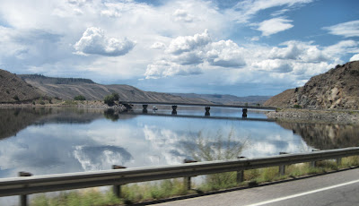
We rode back out on Hwy 135 to Gunnison, made a quick stop at Walmart for camera batteries and then headed west on Hwy 50. The ride around Blue Mesa is always a pleasure, but today the water was still and reflective.

Blue Mesa ReservoirBlue Mesa Reservoir, near Gunnison is Colorado's largest body of water

We chose to ride west today because the bicycle race was somewhere north of us and we did not want to become entangled in the huge crowd we heard were following it. The north rim of the Black Canyon of the Gunnison is not heavily traveled. Hwy 92 is one of our favorite rides. It is about 70 miles from the west end of Blue Mesa Reservoir to Hotchkiss, CO and on a good day this is an awesome ride. The walls and cliffs of the Black Canyon drop about 2000 feet in some places. We could not see as much today because we were riding in the lane farthest from the rim of the canyon and because the weather had rapidly deteriorated.

Rain approaching fast - Black Canyon of the GunnisonBlack Canyon of the Gunnison - CO -- Tim says, we need to get our rain gear on and get the heck off of the rim drive of the canyon... I agreed.

Solid shafts of rain were moving across the canyon faster than we could drive the twisting, turning, climbing road. We stopped at a pull off near the summit of the road, pulled on our rain gear once again and wasted no time getting off the rim of the canyon. Storm clouds chased us all the way up Hwy 92 and across Hwy 133 into Delta. We have been stuck in Delta before because of rain. I told Tim it was not going to hurt my feelings if he shot the gap up Hwy 50 into Grand Junction.

We rolled into Grand Junction and after driving in the evening commute a little too close to downtown for a few minutes, decided to ride to a part of town that was more familiar. We checked into the Affordable Inn on Horizon Drive. We've stayed in this area before although this was the first time at this particular motel. We secured a room on the ground floor, unpacked and covered The Ride. The room is nice enough, decorated in country folk art style complete with quilts instead of bedspreads and a John Sliney (American Folk Artist) patriotic print on the wall. I'm still trying to figure out how to bring it home with me - ha! The room is a little shabby from normal wear and tear I suppose, but very clean. As we strolled down the street, looking for supper, we were peppered with light rain. Thunder rumbled in the distance. The clouds had caught up.

We found ourselves seated in the Applebee's not far from the motel, ordering beer and one of the two for $20 meals. We briefly discussed the day's adventure and turned our thoughts to how we would entertain ourselves tomorrow...

Here is a slide show of the day's ride (76 photos):


Today's mileage = 211.5 miles

Thursday, August 25, 2011

Road Trip #5 - Day 6 Riding Wolf Creek Pass and The Silver Thread

August 24, 2011
Colorado, USA

We enjoyed our stay at the Tomahawk Motel in Cortez, CO. Riding the Mesa and the San Juan Skyway was a blast, but today it was time to ride on. More and heavier rains are due into the southwest corner of the state and a huge bicycle race is rolling north. The cyclists left Gunnison yesterday so we decided to head that way today.

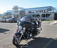
The Ride at Denny's Classic Diner - Cortez, COFirst stop was for breakfast at the Denny's Classic Diner. The diner had great decor inside and out and our breakfast was good. Plus, we needed coffee!

We chose to ride Hwy 160 east to Pagosa Springs, back-tracking on part of the route we rode a few days ago, staying well south of the huge bicycle race. Clouds were already building over the entire horizon to the north and the south. We rolled into Pagosa Springs and gassed up as usual at the Shell station on the west end of town. I purchased a large coffee to fill the thermos. We always meet someone here.

Today, we met a couple of Harley fly-and-ride guys from North Carolina and Florida. They were on rides supplied by High Country Harley-Davidson, a dealership in our neck of the woods. They pulled out a map and we shared some of our thoughts on roads to ride and since they were headed mostly in the same direction as we were, we told them about the pass ahead and recommended the ride north on Hwy 149 (The Silver Thread). We also told them not to miss North Clear Creek Falls along the way and suggested Southern Vittles as a great place to eat in Lake City.

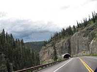
They rolled out before us. We lingered over a cup of coffee. Our route would take us over Wolf Creek Pass for the second time this week. Darn it! Just kidding, traveling over the pass again was not a problem or a lack of planning. As a matter of fact, it has happened before. Ha! From the look of the skies, we were going to get wet up on the pass. That prediction came true near the summit (elevation 10,857) where we had thunder as we pulled on jackets and moisture a short time later, about the time we rolled through the tunnel not too far from the summit.

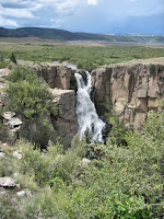
Clear Creek FallsThe next part of the day's ride would be along scenic Hwy 149 out of South Fork. This road is known as The Silver Thread and was named for the rich mining history of the area. The Silver Thread travels through historic Creede, CO, past the head waters of the Rio Grande and North Clear Creek Falls.

Just past Creede, we ran into rain that required a stop to pull on rain gear. Riding on, we met up with Dave and Rick again at North Clear Creek Falls. We were glad to see they stopped as the Falls (with about a 100 foot drop) is quite spectacular despite the look of the surrounding terrain which is mostly pastureland.

Rick and Dave ride The Silver ThreadConversation turned to what lay ahead on Hwy 149 and food. Rick and Dave suggested we ride to eat at Southern Vittles in Lake City. We followed them (so as not to inhibit their view) as Hwy 149 wound its way over the Continental Divide, Spring Creek Pass CO (10,901 elevation) and Slumgullion Pass (11,350 elevation) skirting the La Garita Wilderness before arriving in lovely little Lake City.

Southern Vittles did not disappoint. Tim and I had our customary catfish and okra and shared a slice of apple pie. Rick and Dave had chicken fried steak. We had a great time visiting with them and sharing ride stories. We especially liked hearing their stories as they have been riding for a long time and much farther than we have yet. We want to say thank you guys for treating us to lunch just in case they check in with us here on the blog (I will have the video of your ride put together soon.). A local florist stopped in the middle of the road to take a photo of the four of us. I promised to check in with her the next time we ride through. We swapped emails and left them to check in with work and family as we rode on. They had plans to head west to Montrose at the junction of Hwy 149 and Hwy 50 for the night. Our plan was to head east toward Gunnsion.

The road dried out between Lake City and Gunnison, but the air stayed cool and the skies remained troubled. We checked into the ABC Motel in Gunnison (old and dated, perhaps somewhat over-priced, but clean and quiet). After settling our belongings, we took a short stroll to find beer a couple of doors down, which we iced down immediately and took another stroll to find snacks at a grocery store a couple of blocks away.

Despite the weather, it was a great ride, we made a couple of new friends and enjoyed revisiting a couple of our favorite roads.

Slide show of today's ride (90 photos):


Today's mileage = 293 miles

Wednesday, August 24, 2011

Road Trip #5 - Day 5, Riding the San Juan Scenic Skyway Colorado

August 23, 2011
Colorado, USA

Today, we slept in a little... I guess we needed that after riding Mesa Verde, roaming through cliff dwellings and ruins, then walking two miles downtown, dancing with Indians and walking two miles back to the motel. We do not do the clock-thing when we are on v-a-c-a-t-i-o-n unless we have an event scheduled.

Anyway, we rolled out mid-morning heading east on Hwy 160 to Durango. The idea was to ride at least part of the San Juan Scenic Skyway, the part that includes the Million Dollar Highway. We thought about stopping for breakfast in Durango, but did not see a restaurant that interested us so we gassed up and headed north on Scenic Hwy 550 toward Silverton. What a beautiful ride. Like Mesa Verde, we have not ridden this stretch of road in ten years and the last time was in a cage. Again, that cage trip cannot compare to a motorcycle trip.

Along the way, we looked for signs of the train (Durango-Silverton Narrow Gauge Railroad) which runs along the highway for a while but never caught so much as a plume of black smoke. We rode the train ten years ago and loved it. Engineer Mountain (12,927 elevation) dominates the landscape most of the way while the road winds over Coal Bank Pass (10,640 elevation) and Molas Divide (10,910 elevation) just before riding up on Silverton, CO. Again, we thought about stopping in Silverton for breakfast, but the morning was fine and we were not starved and so far the skies were mostly clear. By this time we were thinking we might get to ride the whole 236 miles of the San Juan Skyway without riding into storms.

San Juan Scenic Skyway - Hwy 550San Juan Scenic Skyway - Hwy 550 CO

So, we rode on. The Million Dollar Highway is typically defined as the 25 miles between Silverton and Ouray, CO although some refer to the whole stretch of road between Durango and Ouray as such. It travels over Red Mountain Pass (11,099 elevation) through the Uncompahgre Gorge. The 12 miles or so of road from the summit of Red Mountain Pass to Ouray is actually the stretch of road that gives the highway its name. Legend has it that the name Million Dollar Highway is derived from the idea that it cost a million dollars a mile to build in the 1920s, and that its fill dirt contains a million dollars in gold ore. The Million Dollar Highway is notorious among travelers because the gorge is challenging and potentially hazardous to traverse by vehicle, mostly because the road winds via numerous hairpin S-turns beside steep cliffs (sometimes close enough to touch), narrow lanes, and a decided lack of guardrails. Notorious or not, riding up to Ouray was a blast and we were tempted to ride back down it and back up again -- just for the fun of it.

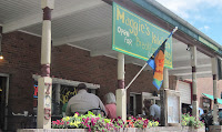
Maggie's Kitchen - Ouray, COBy the time we rode into beautiful downtown Ouray, the rumble in our stomachs told us it was way past time to eat. We parked the ride and strolled down the street a couple of blocks before we spied Maggie's Kitchen. When we stopped in front of the place to look it over a little better, an elderly gent said C'mon up - it's the best place to eat in town. He said he'd been eating there for as long as he could remember and they had not killed him yet. Well, we laughed and told him that's all the persuasion we needed. As we mounted the stairs, he told us to go on in, straight to the order window in the back and said tell them Gilbert sent you.

We strolled in and paused about half way back just to gawk a minute. The entire place, every inch of wall and ceiling is signed by the people who have visited Maggie's. Amazing! Otherwise the decor was low key, mostly galvanized tin and wood - our kind of place. We told the girl at the order counter that Gilbert sent us in with the highest recommendation. The girl giggled and said - Yeah, that's my Grand-Dad. Tim ordered a monster bacon cheese burger with fries. I ordered a smaller version of the same. The place was busy so we grabbed our drinks, and yes - signed the wall, then found a small table on the street side patio out front and got a kick out of watching Grand-Dad Gilbert work the crowd of hungry tourists strolling by.

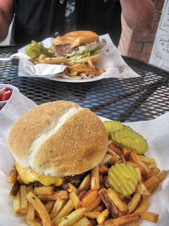
The burgers. Speaking quite literally - Oh My Goodness! They were cooked to perfection, juicy and tasty! Loaded with wonderful cheese (definitely not your standard slice)! We are still trying to remember when and where we have had a better burger.

Bacon cheese burgers - Maggie's Kitchen - Ouray COBacon cheese burgers - Maggie's Kitchen - Ouray CO

Slide show of the ride between Cortez and Ridgway, CO or part one of the San Juan Scenic Skyway which includes the Million Dollar Highway (75 photos):


Riding north out of Ouray under partly cloudy skies, we were soon through the small town of Ridgway, CO. In the past, we have always continued north at this point. Today, we turned west on Highway 62 and immediately wondered why we have not traveled this stretch of road before. This stunningly scenic ride travels over the Dallas Divide (8970 elevation) about halfway between Ridgway and Placerville, CO over and around gently rolling hills and through lush, green valleys. Before long we reached Hwy 145 and rode the few miles into Telluride. The ride into and up to the city limit sign of Telluride was great. What I assume was Bridal Veil Falls was a trickle down the mountain at the end of town. It is a beautiful, busy, Victorianesque town but, cruising main street of Telluride was like riding a cattle trail... Seriously. We have ridden through cone zones that were better. We could not help but wonder, with all the money (movie stars, rock stars and so on) purportedly living in the area how the streets could be so bad. We did not linger, cruising in and back out of town pretty quick although cruising implies something other than the bumpy ride we experienced.

We missed a turn coming out of Telluride and rode north a few miles before discovering our error. We did not mind it - this part of the road was nice if a bit busy. Before turning south on Hwy 145 just outside of Telluride, we stopped at a scenic pullover and had a cup of thermos coffee.

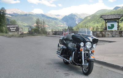
The Ride - near TellurideThe Ride, near Telluride, CO

Highway 145 travels over Lizard Head Pass (10,222 elevation) between Telluride and the tiny almost ghost town of Rico, CO. This is a beautiful, easy ride through some gorgeous terrain. Rounding a bend, just past Lizard Head Mountain we realized we would not finish the day in the dry. We stopped, pulled on the rain gear and rode through rain between Rico and Dolores, stopping just shy of Dolores to come out of the now steamy rain gear.

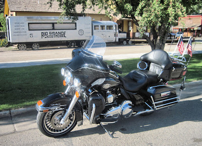
As we were riding through Dolores, I spied the Galloping Goose which I had read about in a travel brochure at the motel.

The Ride with Galloping Goose #5The Ride with Galloping Goose #5 - Dolores, CO

Here's a brief history: The 160 mile Rio Grande Southern Railroad was built in the early 1890s to accommodate travel between Ridgway, CO to Durango, CO running through the towns of Telluride, Rico, Dolores and Mancos. It served the silver and gold mines of Telluride, Ophir and Rico, hauling tons of precious metal ores and passengers, its success thwarted only by the Silver panic of 1893. After the stock market crashed in 1929, the railroad almost failed until a new type of rail vehicle was conceived that could haul freight, passengers and the US Mail. These vehicles (I believe there were 7 of them) became known as the Galloping Geese (apparently the horns on these vehicles or motors sounded like a flock of geese). Galloping Goose number 5 (sitting at the Depot in Dolores) was originally built using a 1928 Pierce-Arrow limousine body and running gear. By 1953 when roads were built in the area and the US Mail did not renew its contract, the RGS became defunct. The historical society that maintains Galloping Goose #5 has plans to build a section of track between Dolores and Mancos to give tourists a taste of its colorful history. Sounds like fun to me!

Sleeping Ute Mountain - Cortez, COThe rest of the ride into Cortez was pleasant. The view of Sleeping Ute Mountain was good from this perspective. For once, we got to ride dry through the town and into the motel. After the great burgers at Maggie's, neither one of us were hungry so we snacked and had a beer, lounging in front of the room speculating on where tomorrow would take us.

Slide show of the ride between Ridgeway and Cortez, CO or part two of the San Juan Scenic Skyway (50 photos):


The day's mileage = 358 miles. Tomorrow we leave Cortez - thinking maybe Gunnison as we are trying to stay out of the path of storms rolling up from the south and some huge bicycle event going on in the state.

Tuesday, August 23, 2011

Road Trip #5 - Day 4, Mesa Verde Ride

August 22, 2011
Colorado, USA

When we decided to ride to the southwest corner of Colorado, we had it in mind to ride Mesa Verde. The last time we visited Mesa Verde was ten years ago in September 2001 just after 911. We were in a cage.

After yesterday's heavy rain and thunderstorms, it was a pleasure to see bright, blue skies. We skipped breakfast and made a quick stop at Walmart to pick up the makings of a picnic lunch.

Mesa Verde is just a few miles east of Cortez on Hwy 160. We rode by the mesa yesterday on our way in but barely spared it a glance as we hustled into Cortez ahead of the storms.

Tim & Vik - Mesa Verde COTim and Vik enjoy a ride through Mesa Verde National Park - Colorado

We spent the entire day riding the beautiful roads of the mesa, roaming through the cliff dwellings and ancient ruins. We had our picnic in a secluded spot near the edge of a canyon. It was everything we remembered and perhaps more. For certain, it was much more fun on the motorcycle. We met and chatted with people and other bikers at all the stops along the route.

Slide show of the Mesa Verde Ride (96 photos):


Alternate link to this slide show

As we rode down the Mesa late in the afternoon, we once again encountered troubled skies. We rode into our motel a bit damp, covered The Ride and after a while made the decision to walk (about 2 miles) to the downtown area in search of supper and perhaps entertainment of a local nature. Storms threatened on the horizon but skies overhead didn't look too bad. Besides, we will not melt.

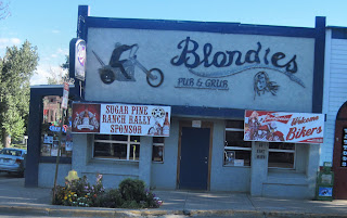
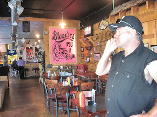
Downtown, we found a biker-friendly restaurant called Blondie's Pub n Grub. It was larger than it looked, clean and quiet (it was still early in the evening) and the walls were filled with interesting biker photos. The place showed signs of a healthy night life, complete with space for live entertainment and a collection of bras hanging from the antlers of a critter on the wall. We settled on blackened catfish and beer. The meal was OK. That's all I got - OK. Blackened where we come from is more than just serving broiled fish with the blackening spice sprinkled on top. Our plates came out with a single, throw-back size catfish filet surrounded by a few veggies. We thought it was a bit pricey for basically what qualified as a plate lunch. OK means it filled the hole, but we will not visit the establishment again (at least, not for a meal).

Blondie's Pub n GrubBlondies Pub n Grub - Cortez, CO

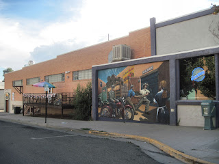
Mural on side of BlondiesMural on side of Blondies

Tim at BlondiesTim at Blondies

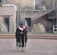
After supper, we walked the short distance off the main drag to the Cortez Cultural Center. I had read about it online and our motel host reminded us that the center hosts American Indian dances nearly every night. We had ample opportunity and time to view the collection of Native American artifacts in the center and the Pueblo scene mural painted on the building's exterior before finding a seat to watch the dances.

Ute dancer - chose TimThe Lopez family (Catching Eagle Dancers) from nearby Towaoc performed Ute dances for our enjoyment. The father introduced each dancer (all girls) and explained the significance of the costuming as well as the historical tradition of the dance we were about to see. We enjoyed the dances and the music, finding it all really interesting. I wish I could remember the names and details of all the dances but the only ones I recall are the Fancy War dance, the Jingle Dress (a beautiful dress adorned with bells) dance, the Eagle feather dance and something about a Crow dance. As I said, the dancers were all girls. With that in mind I knew there would be some sort of interaction with the crowd, probably at the end of the exhibition. When the father started describing a mating dance I knew those girls were about to involve the men-folk in the crowd. The father explained that to refuse a maiden's invitation to dance was an insult and would require payment in the form of a horse or something like that. Get this. I knew Tim would be chosen and I knew which girl would choose him. When the lovely young lady made straight for him and put out her hand - I told Tim to get on out there because I wasn't about to hand over the Harley. Ha! (Sure, I have video - stay tuned for the mini-movie - coming soon.) After the mating dance in which Tim performed fairly well, the rest of us joined hands and danced a circle dance... Oh yeah - that works out great after walking two miles in biker boots.

By this time, it was dark but we enjoyed the long walk back to the motel where we got comfortable (out of those boots) and relaxed in the chairs outside our room with a cool beverage well into the evening.

Here are a few pics of the Cultural Center and the American Indian Dancers (25 photos) I shot more video than stills so the movie will be better.:


This days mileage = 90 miles and we made a full day out of it. Yawn!

Sunday, August 21, 2011

Road Trip #5 - Day 3, The Ride to Cortez

August 21, 2011
Colorado, USA

What a great ride! We rested well last night in our cozy room at the Mecca Motel, probably a little too well as we didn't get as early a start as we thought we might. Rain rolled through overnight but The Ride was covered and all was dry by the time we rose. We rolled northwest out of Colorado Springs on Hwy 24 about mid-morning, under mostly blue skies in search of breakfast. Denim jackets were sufficient to ward off the chill of the morning after a rainy night.

The Ride parked in front of The Hungry Bear - Woodland Park, COA blogger friend recommended The Hungry Bear Restaurant in Woodland Park not too long ago so we rolled in and put our name on the list along with half the rest of the world. After waiting a while we spotted a couple of empty seats at the bar that suited us fine. Thanks for the recommendation motoroz of Just an Ordinary Biker Blog! We loved The Hungry Bear. It is definitely our kind of place. What we could see of the decor (the place was packed) was what some would call dated. I call it homey and quaint. The bear collection is amazing. The coffee was hot and rich and they kept it coming. The pancakes we ordered with our two egg/3 bacon breakfast were fantastic. The wait staff were all friendly and efficient. Sorry, it all looked so good I didn't even think about taking a photo before digging in. Ha! Not to worry - there will be a next time.

We rolled west now out of Woodland Park, still traveling on Hwy 24. This part of our journey would take us over Ute Pass (9165 elevation) between Divide and Florissant, then over Wilkerson Pass (9507 elevation) between Florissant and Hartsell where the panoramic view of the Collegiate Peaks in the Sawatch Mountain Range looming over the valley basin is jaw-dropping. Scenic Hwy 24 travels over Trout Creek Pass (9346 elevation) between Hartsell and Johnson Village before junctioning with Hwy 285. Traveling south now along one of our favorite roads, we rode beside the majestic Collegiate Peaks to Salida (detouring through downtown Salida - just for the fun of it) before heading south again through Poncha Springs. Just a few miles south of Poncha Springs we traveled over Poncha Pass (11,312 elevation). The approach to this pass is so mild you don't even realize it is a pass until you feel the chill of altitude or see the summit sign.

Tunnel - Wold Creek PassWe followed Hwy 285 all the way to Monte Vista which we haven't visited in a long while. The road was great and the travel was easy. We picked up Hwy 160 west out of Monte Vista rolling toward South Fork looking forward to riding Wolf Creek Pass (10,850 elevation). This pass is one of our favorite rides. I never get over it, especially from this direction without the tune to C.W. McCall's song of the same name ringing in my head -- Wolf Creek Pass, way up on the Great Divide... Truckin' on down the other side... Right in the middle of the whole damn show was a real nice tunnel, now wouldn't you know? Sign says clearance to the twelve-foot line, but the chickens was stacked to thirteen-nine. Well we shot that tunnel at a hundred-and-ten, like gas through a funnel and eggs through a hen, and we took that top row of chickens off slicker than scum off a Lousiana swamp. Went down and around and around and down 'til we run outta ground at the edge of town. Bashed into the side of the feed store... in downtown Pagosa Springs. Wolf Creek Pass, way up on the Great Divide... Truckin' on down the other side...

Near DurangoSkies near Durango CO

Cortez was the destination we had in mind. Between Pagosa Springs and Durango the skies got much more interesting. The clouds were dark, sparking lightning and the rain shafts looked ominous. We ran into light rain near Durango and wasted no time getting out of the edge of the city and through the canyon on the other side. We traveled in and out of light rain all the way to Cortez. The rain got heavier as we entered town. We looked at motels, but quickly decided on one for which I remembered good reviews. We managed to get checked into the Tomahawk Lodge, hurriedly unpacked and got The Ride covered before the downpour. We had heavy rain, thunder and lightning the rest of the evening. Now, there was fast food a short walk away but it would be an ankle deep, wet walk. Tim found beer in a mad dash at a convenience store in the gas station across the street. I found a Pizza Hut in the phone book and ordered pizza and wings. We iced the beer down in one of the room's trash cans and dined at the small table in our room.

The Tomahawk Lodge is as nice as the reviews. Extremely clean and comfortable. The owner is very nice. She and one of her two huge black and white great danes (his name is Harley) greeted us immediately with a smile. She was happy to show us the room first. We will stay here three nights...

This day's mileage = 359 miles over five passes.

Slide show of today's ride (86 photos):

Saturday, August 20, 2011

Road Trip #5 - Day 2, POW-MIA Recognition Ride & Veterans Rally

August 20, 2011
Colorado, USA

Day 2, 20th (part 1), POW-MIA Recognition Ride

After a great night's rest at our cozy motel, we were up early and riding toward Woodland Park before 7 am. The weather was fine and skies were clear.

This is our third year to ride in the POW-MIA Recognition Ride. We ride with Veterans. We ride for Veterans. We ride for those who gave some. We ride for those who gave all. We ride because it is fun, but we also ride with remembrance and respect in our hearts. We ride in celebration of the dearly bought freedom that allows us to do this thing [ride the Harley] we love but we ride with the certain knowledge that Freedom is not Free.

POW-MIA Ride StagingRegistration is a bit funky for this ride, mostly because the number of riders who turn out for it is huge. You ride in, sign a release while still on the bike, park, dismount, walk to the registration table, pay the $5 fee, go back to the bike, ride to the staging area and park again. This works fairly well until hundreds of bikes show up at the same time to register. Every year I think to myself that organizers should consider some sort of pre-registration. We staged near the end of the second row. They packed us in like sardines this year with barely enough room to get off or walk around the bike.

Local firemen were cooking for the pancake feed this year. We got in line, put a decent donation in the jar and had our pancakes, sausage, orange juice and coffee. Afterwards, we stood around and visited with other bikers while watching hundreds of bikes roll in for the next couple of hours.

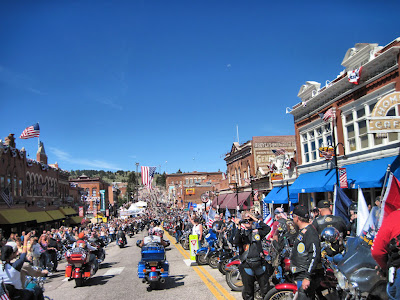
POW-MIA Ride strung out behind usThe POW-MIA Recognition Ride rolled out right on time under clear skies with Pikes Peak presiding over the whole event. Like last year, bikes were still registering as we were riding out. It was a great turnout. Patriot Guard Riders from Kansas and elsewhere led the ride through Woodland Park to Divide and on to Cripple Creek. All along the way patriots of all ages, from all walks of life cheered and waved flags alongside the roadways. We responded with waves and honked our horns. The bikes stretched out for miles in front and in back of us (the majority being behind us). Words somehow seem inadequate to describe both the thrill and the honor it is to ride in this procession.

POW-MIA Ride - Cripple Creek CORoaring into downtown Cripple Creek where the streets were lined with thousands of people cheering and waving and screaming rev 'em up is a one of a kind experience. Riding under the big flag at the end of main street gets me right in the old ticker every time and puts a big ol' lump in my throat.

Do not believe anyone who says patriotism is dead in America. It is not. Patriotism is alive and kicking wherever Veterans and Soldiers and those who appreciate Veterans and Soldiers gather. Patriotism flies free and proud overhead from rooftops, street lights and fence posts, in the hands of patriots, and streaming proudly behind thousands of motorcycles. Patriotism sends a message loud and clear from the patches and artwork adorning every leather vest, t-shirt and cap. Patches that say these colors don't run, try burning this one [flag] asshole, land of the free - because of the brave, proud American Infidel, Vietnam Veteran, love it or leave it, all gave some - some gave all, wind in my face - freedom in my heart, support our troops, don't tread on me, we went - we served - we ride - with USA pride and Freedom is not Free. I am proud to associate with people who remove their hats, place hands over hearts and salute as Ol' Glory marches by. The kind of people who do not choke on the words to the pledge of allegiance and who are not embarrassed to sing loudly while they shed a tear during the national anthem and other patriotic songs. I am at home with people who know exactly who they are, exactly where they belong and exactly what they stand for.

We rolled down the back street, parked in nearly the same place as last year, took our time stashing our gear and walked up to main street in plenty of time to see hundreds more bikes still riding in.

Here is a slide show of the POW-MIA Ride (78 photos):


Day 2, 20th (part 2), Salute to American Veterans Rally

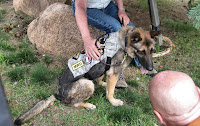
Bady - American Hero DogWe listened to the speeches and patriotic songs broadcast from the tiny city park during the commemorative ceremonies. We loved the story of Bady or Bad A, a German shepherd who lost his handler in an explosion in Afghanistan. Bady is an IED & Patrol dog and is credited with saving over 100 Soldiers. Bady lost a leg as a result of injuries suffered during the explosion. Bady was presented with an honorary Combat Action Badge by Col Mike Kasales of Ft Carson. It was pinned to his vest. He was also awarded a trophy in recognition of his courage and dedication in protecting our American Soldiers. Check out the video of Bady at http://www.koaa.com/videos/hero-dog/.

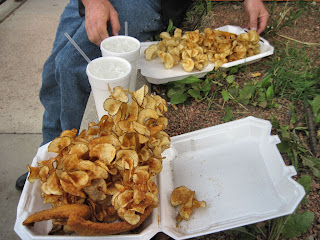
Catfish & Twisted TatersLunch was catfish and twisted taters from DC's.

The rally was packed and the weather was fine most of the day. We shopped the vendors, listened to music, strolled the streets of Cripple Creek, admiring the bikes parked and other bikes riding in. We stopped for a gander at Colonel Bill McPherson's restored UH-1 Huey helicopter. McPherson was on his 197th combat mission June 1966 when his aircraft was shot down. He was severely wounded and his co-pilot was killed. He has restored two UH-1 Huey helicopters. One he regularly pulls through parades. The other is on static display at the Veterans Memorial in Mount Pisgah Cemetery just above Cripple Creek.

We stopped for an ice cream before getting the idea we were about ready to ride down the mountain. We were kicking around here or there supper ideas. A crack of thunder convinced us our inclination to get moving was well founded - us and a bunch of others. So, we rode down the mountain in spotty rain, but the weather in Colorado Springs was fine. We found burgers and beer a short distance from our motel at tiny Mo's Diner and spent the rest of the evening watching a lightning show over Pikes Peak from the chairs in front of our motel room.

Slide show of the Salute to American Veterans Rally (76 photos):


We had a great time today. Tomorrow we roll out of here on a seven, maybe eight or nine or ten day road trip...

FYI: Of course I shot video - stay tuned for the movie

Total Mileage 25190
Day's mileage = 85 miles

Friday, August 19, 2011

Road Trip #5 - Day 1 - Ride to the Veterans Rally

August 19, 2011
Colorado, USA

Day 1, Friday

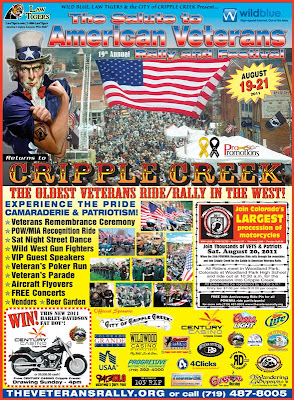
We rolled out of the drive this morning about 9am under partly gray skies in no particular hurry. This road trip began in Cripple Creek with The Salute to American Veterans Rally - 19th Annual. Cripple Creek is an easy ride from our neck of the woods.

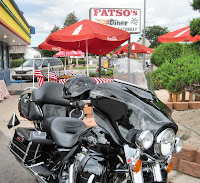
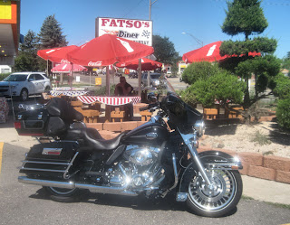
The Ride at Fatso's DinerBreakfast was our first stop. Biscuits and gravy at Fatso's Diner got the day off to a great start. The next stop was High Country Harley-Davidson in Frederick, CO. Since it is well over a year old and we are headed out on a lengthy road trip, we decided to replace the battery in the fob for The Ride.

The ride to Colorado Springs was easy and uneventful. We traveled familiar roads through the the small towns of Golden, Morrison, Deckers and Woodland Park. The skies spit on us near Woodland Park, but not enough to slow us down. We rolled into one of our favorite overnight stops, the Mecca Motel (see reviews page) on Old Colorado Blvd in Colorado Springs about mid-afternoon. After checking in to our great room and unloading The Ride, we made the short trip to Cripple Creek. We wanted to purchase our Rally shirts, patches and pins so we can wear them tomorrow.

The odometer rolled over 25,000 miles between Colorado Springs and Woodland Park. The Ride will be sixteen months old on the 28th of this month. We will likely add another thousand, maybe two thousand to the odometer before we call it quits on this trip. There were a good many bikes rolling down the mountain as we were headed up and there were lots of bikes parked or roaming the streets of Cripple Creek as we arrived. It was not as crowded as last year on Friday, but we were there a little later in the day. We found the rally merchandise tent and took care of that business. A shirt for Tim, a shirt for me, a couple of rally pins and rocker patches made a $50 bill vanish. We roamed through the vendors that were open for business and Tim signed the Veterans Wall while I signed it for Dad.

Ezell Memorial BikeWe admired the Lawrence David Ezell Memorial Bike. Ezell, a Texan, was a Fort Carson soldier, killed in Baghdad, Iraq in 2008. After seeing the Patriot Guard Riders in action at this hero's funeral in Arlington National cemetery, his wife donated the bike to the Patriot Guard Riders of Colorado. The bike has been customized with paint and leather work and will be placed on display in the Fort Carson Museum when construction of the facility is completed. Part of the fun of a motorcycle rally is admiring all the bikes and so, we did as we walked main street of Cripple Creek.

We decided to head down the mountain a short while later. Breakfast had worn off and supper was calling. The ride down the mountain was as easy as the ride up and the skies were looking better. Savelli's Pizzaria (see reviews page) is a healthy walk (about a mile) from the motel. The best Eggplant Parmesan we have ever had, a couple of dishes of pasta, cheesy bread sticks and perfectly chilled beer put a nice finish on the day.

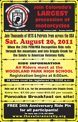
Tomorrow we ride in the 24th Annual POW-MIA Recognition Ride... stay tuned.

Beginning mileage 24814
Day's mileage = 291 miles

The following is a slide show of the day's ride (43 photos):

Thursday, August 18, 2011

Here we come again Cripple Creek!

August 18, 2011
Colorado, USA

2011 Salute to American Veterans Rally Poster19th Annual Salute to American Veterans Rally Poster 2011

POW-MIA Recognition Run24th Annual POW-MIA Recognition Run 2011 Poster

Vet Rally T-Shirt2011 Salute to American Veterans Rally T-Shirt Art

Wednesday, August 17, 2011

Last year about this time...

August 17, 2011
Colorado, USA

Woo-Hoo! Can you say road trip!
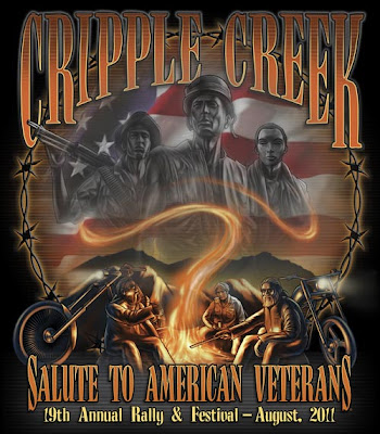
We are riding out again to the Salute to American Veterans Rally in Cripple Creek, CO. This will be our third year at the Vet Rally. In 2009 we rode in the Winter Park POW-MIA Recognition Ride for the rally. Last year we rode with thousands of other motorcycles in the POW-MIA Recognition Ride from Woodland Park, CO to Cripple Creek, CO. This year we plan to ride again. It is one helluva experience riding with Veterans, members of our Armed Forces, and Patriots, engines roaring, flags flying and people cheering along the roadside.

The following is a slide show of last year's POW-MIA Recognition Ride.

2010 POW-MIA Recognition Ride Slide Show

FYI: Not all of the following pics are in focus (they are taken from the back of a motorcycle), but I included them anyway because those people standing on the side of the road cheering us on deserve as much recognition as we riders... they are patriots one-and-all. Here is a slide show of the POW-MIA Recognition Ride (100 photos):


Sunday, August 7, 2011

Nother High Country Ride

August 7, 2011
Colorado, USA

The Ride - Fatso's DinerThe Ride - Sunday morning B&G stop - Fatso's Diner

After a lazy morning drinking coffee on the patio, we decided to ride out and get some breakfast at Fatso's Diner in Loveland, CO. You guessed it - biscuits and gravy and more coffee.

Heading west on I-70Heading west on I-70

Temps were warming into the 90s. We had the whole day ahead of us so we were thinking perhaps another cool high country ride. Riding Hwy 287 South, we cut across to Hwy 95 and caught I-70 out of Golden. Riding anywhere near I-70 on a Sunday is breaking one of our travel rules. The traffic is just too nasty on the interstate at the end of a weekend. About Idaho Springs we noticed the eastbound traffic was already backed up for miles and moving at a crawl. It was just after noon. We could not get to the exit for Hwy 40 north fast enough.

Hwy 40 - Berthoud Pass, COHwy 40 is a scenic route which travels over Berthoud Pass (elevation 11,307) and crosses the Continental Divide. It gets a bit chilly on this ride (let's call it brisk), but we toughed it out without stopping for jackets. The road has several fairly harsh switchbacks and travels through Winter Park, Tabernash and Fraser. The resort town of Winter Park sits at an elevation of 12,060 at one point although the village sits at about 9000. The town was gearing up for an afternoon music fest but no bands were on stage yet as we rode through.

We rode on, still sleeveless through the high mountain valley towns of Tabernash and Fraser. Soon we were rolling into Granby which sits at an elevation just under 8000. We noticed lots of new construction along the way and new houses dotting the valley in peculiarly located neighborhoods which just look out of place. We remarked that the little towns were suffering from growing pains.

Near Continental DivideNear Continental Divide

We stopped for a stretch and a coke at a convenience store on the north end of town. We spoke with a biker who was talking with the store clerk, trying to get directions to Thunder Mountain Harley-Davidson that would get him there before closing. Thunder Mountain is the closest dealership to where we live. The biker was from Pennsylvania and had ridden across country swinging south through Arkansas, picking up riding companions in Texas before riding into Colorado on his way to Sturgis. The clerk said the most direct route was through Rocky Mountain National Park. It is, but the biker balked at paying the high park fee. It is $10 per person on a motorcycle. Then a local suggested I-70. At this point Tim interjected and advised the I-70 route was a bad idea on a Sunday afternoon. The man agreed as he had traveled up that way just before us. Tim told the man, the best route was through Walden but it would be damn near impossible to travel that distance in the time required. The biker was in pursuit of a Thunder Mountain t-shirt. I was sorry I wasn't wearing one today or I would have offered it to him - ha! I reminded Tim that since it is Sturgis bike week that the dealership was likely operating under extended hours. Tim pulled a dealer card out of his wallet and the biker called the dealership. A few minutes later the biker and friends were rolling out toward Walden.

Hwy 125, COFrom Granby one can travel on Hwy 40 to Steamboat Springs or Hwy 34 through Rocky Mountain National Park or Hwy 125 to Walden. The latter was our choice for a return route today as well. We had not traveled this particular route, until today. Hwy 125 is a long, lonely road. It starts out scenic and travels over Willow Creek Pass (elevation 9621) and Crosses the Continental Divide. Neither one of us wanted to admit it, but we could have used our jackets for part of this ride. After a while the road and the terrain flatten out with the mountains only a jagged shadow on the horizon. The winds were howling. We passed through the tiny community of Rand which has a general store we have heard about. The store was not open so we rode on.

In Walden, we stopped to get gas before heading east on Hwy 14, traveling the familiar 100 miles or so to home. The Pennsylvania biker and friends rode by and turned onto Hwy 14. They were coming from the wrong direction so we suspect they missed the turn. There's not much north of Walden except the tiny community of Cowdrey and the Wyoming border. The wind was a terror until well past Gould.

We passed the Pennsylvania biker and friends pulled over just before The Crags. They were pulling on jackets. They passed us a short while later. We were doing the same thing at one of the scenic pullovers - putting on jackets before traveling over Cameron Pass.

The Ride - Nokhu Crags - Hwy 14, COThe Ride - Nokhu Crags - Hwy 14, CO

FYI: The road damage just before the scenic pulloff at the Nokhu Crags is horrible. The drop off in the eastbound lane is about six inches and the only safe place to pass through is on the center line. The buckle in the west bound lane is just about as bad. The pull off has a wide crack near the edge. There are signs posted but not very far out and there is no speed reduction advised. It should say slow-slow-slow. Signs say road repairs are coming soon but they better hurry because from the looks of it the road is sliding off the edge of the mountain.

The ride home went well. As soon as we got over Cameron pass, we found a spot to come out of our jackets. We finally got tired of the traffic traveling down the Poudre Canyon and took an alternate route -- Stove Prairie Road through Buckhorn Canyon, to Masonville, around the southern end of Horsetooth Reservoir and home.

We polished off the day with a couple of beers and mikes and burned a dog on the grill.

Today's ride was a lazy 310 miles...

Slide show of today's ride (35 Photos):

Saturday, August 6, 2011

High Country Picnic Ride

August 6, 2011
Colorado, USA

Clear Creek CanyonToday we rolled out under warm, cloud-dappled, blue skies for a 230 mile picnic ride. We rode north on the side roads and country lanes until we reached Hwy 119 near Golden which we traveled through Clear Creek Canyon toward the gambling towns of Blackhawk and Central City. Lots of people were headed up to lose a little money in the slots so the canyon was busy. Road repairs are ongoing in the canyon. We jogged over to I-70 via Central City Parkway. We love riding this 8+ mile stretch of road. From Idaho Springs we traveled a couple of exits on I-70 to Hwy 103 also known as Squaw Pass Road. This is one of our favorite roads. We had no plans to travel to the top of Mount Evans over the highest paved road in America but from the looks of it, plenty of other people were doing that very thing. Echo Lake, the picnic grounds and Echo Lake Lodge (really just a gift shop and restaurant) were as crowded as we have ever seen them on a non-holiday weekend.

Vik - picnic near Mount Evans, CO?We traveled on by the crowds, our destination, one of our all time favorite picnic spots. We were happy to find our table vacant. This particular picnic spot overlooks Mount Evans to the west and verdant wooded foothills and valleys to the east. There's a great overlook down a path that many people never find. We shared the secret with a friendly young biker couple from Lakewood who stopped by our table for a chat. From the sound of their laughter and the number of photos they shot, we assumed they were enjoying the spot. Ha!

View from our tableView of Mount Evans from our table - Squaw Pass, CO

Spreading out our cold fried chicken, noodle salad, fruit bowl, cookies and ice tea, we enjoyed a leisurely lunch in the cool mountain air and bright sunshine.

Before riding out, we strolled the short path to the overlook and snapped a few pics.

Vik - Squaw Pass - Hwy 103 - COVik - Squaw Pass - Hwy 103 - CO

Tim - Squaw Pass - Hwy 103 - COTim - Squaw Pass - Hwy 103 - CO

FYI: I'm sorry to report that while a few repairs have been made, the east side of Squaw Pass Road (Denver side) is in really bad shape and in dire peril of reverting to a cow trail. What were chips, potholes, cracks and crevices are (after sloppy repairs) bumps, waves and buckles. Sigh! So much for our vehicle tax dollars... lots and lots of tax dollars. So, travel Hwy 103 cautiously especially on two wheels.

The trip home was uneventful. We traveled north through the western suburbs of Denver, stopping for ice cream of course and then peeled off of the main thoroughfares in favor of riding rural roads home. We rolled in about 7 pm and as is our custom, spent the rest of the evening on the patio with a fire in the chiminea and a brew in hand.

Here is a slide show of today's ride (46 photos):